Document details
7
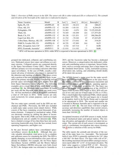
1
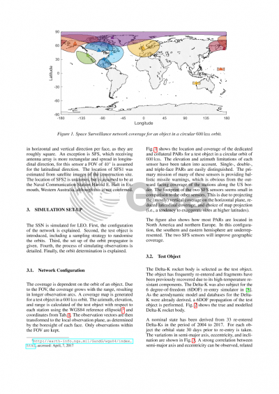
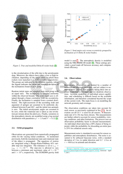
T. Flohrer, F. Schmitz

Abstract
Two-Line Elements (TLEs) resulting from the Space Surveillance
Network (SSN) are often the only available source for many Space
Situational Awareness (SSA) activities such as conjunction analyses
and re-entry predictions. The network consists of many different
radar and optical stations, contributing in either a dedicated,
collateral and contributing fashion. For low-Earth orbit radar
stations are primarily employed. Radar station can be further
distinct into phased-array and mechanically steered
radars. Uncertainties in TLEs are primarily a product of sensor
capabilities, model deficiencies, network geometry and
configuration, and orbit determination setup.
The aim of the paper is to separate and analyse the individual
contributions and identify potential areas of
improvement. Specifically, the configuration and geometry of the
network is investigated. Only the LEO satellites are
considered. Further, although mechanically steered radars are
generally much more accurate, only phased-array radar stations,
capable of tracking many object, are considered.
The SSN is simulated as a collection of present and hypothetical
dedicated and collateral radar stations. An investigation into the
current state of the SSN is performed. The location and coverage of
each station is accurately estimated and modelled. Range and
range-rate measurements are generated for several setups over a
number of revolutions. Noise is introduced to individual
observations to account for sensor capabilities (e.g. power and
resolution) and secondary disturbances. Lastly, observations are
edited out to account for sensor availability, viewing conditions,
and other limitations. TLEs are estimated from the simulated
measurements using Simplified General Perturbations (SGP4)
model. GOCE during its re-entry phase is used as the reference
satellite. During this final phase the thruster was switched
off. GPS derived orbits are considered as truth for assessing TLE
accuracy. The optimal number of measurement and passes are
investigated to achieve the best state estimates. The resulting
simulated TLEs are compared against actual historical TLE estimates. Several network configuration consisting of different combinations
of stations are investigated, including historical, present,
proposed and hypothetical scenarios.
Individual sensors are shown to be the primary factor in the overall
accuracy of the initial state. Sensor accuracy, however, is
difficult to improve, due to the associated cost and trade-off
between accuracy and capacity. The network itself is found to be
underrepresented in large regions of the world. The new proposed
space fence, with sites in the Marshall Islands and Western
Australia, improves the geometry and overall accuracy
significantly.
Preview