Document details
6
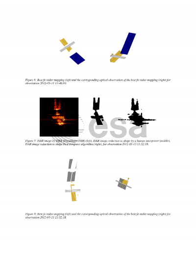
1
L. Ouwehand

Abstract
Inverse synthetic aperture radars (ISAR) are a valuable instrument for assessing the dynamic state of a large object in low Earth orbit. In particular, the images generated by these radars can reach a sufficient resolution to be used during launch support or contingency operations in low Earth orbit, i.e. for confirming the deployment of structures, determining the structural integrity, or analysing the dynamical behaviour of an object. However, the direct interpretation of ISAR images can be a difficult task due to the nature of the range-Doppler space in which these images are produced. To support the interpretation process, a tool has been developed by ESA's Space Debris Office to generate radar mappings of a target in orbit. Such mappings are a 3D-model based simulation of how an ideal ISAR image would be generated by a ground based radar under given processing conditions. As the process for generating ISAR images assumes a scattering body, a rudimentary 3D model of the target is sufficient in order to derive information from the generated maps. Processing predefined attitude states in comparison with actual observations allows it to detect non-nominal behaviour or to determine attitude states of the target.
Preview