Document details
9
1
S. Lemmens, T. Flohrer, F. Schmitz

Abstract
In this study, the infrared images obtained during the approach to the upper stage of the orbiting rocket in the Commercial Removal of Debris Demonstration (CRD2) Phase I project are compared with simulated images that had been generated in advance for ground validation of the navigation system, and the validity of the image generation simulator and thermal analysis model are evaluated.
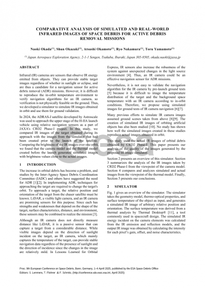
An infrared camera is a sensor that observes infrared energy emitted by objects. It is expected to provide stable target images regardless of sunlight or eclipse, and is considered to be one of the candidate navigation sensors for Active Debris Removal (ADR) missions. On the other hand, when validating navigation algorithms using an infrared camera, it is difficult to reproduce the temperature environment on orbit, making it difficult to validate with an actual camera on the ground. Therefore, we have been working on a simulator that simulates the infrared images that would be obtained in orbit and can be used for ground validation. Our simulator inputs the thermo-optical properties and surface temperatures of the target and calculates the infrared input energy to each pixel of the infrared camera. The simulator then converts the infrared input energy to pixel values according to the sensor characteristics and outputs a simulated infrared image. The surface temperature to be read into the simulator is the result of a thermal analysis from a standard thermal analysis tool. A thermal model of the target is required to perform the thermal analysis. However, direct measurements of the thermo-optical properties and temperatures of objects that have been in orbit for long periods of time are usually not available. We had developed a plausible thermal model and simulated images based on prior information about the target and the results of UV degradation tests of the insulation material.
The ADR mission is expected to capture the target and change its orbit. It is useful to be able to generate an appropriate thermal model of the target in advance in order to properly estimate the thermal input that the chaser satellite will receive from the target during capture and to apply it to the thermal design.
The CRD2 program is a JAXA program aimed at enabling commercial companies to acquire technology for approaching and removing space debris, which is a non-cooperative target.
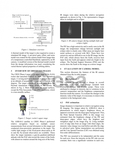
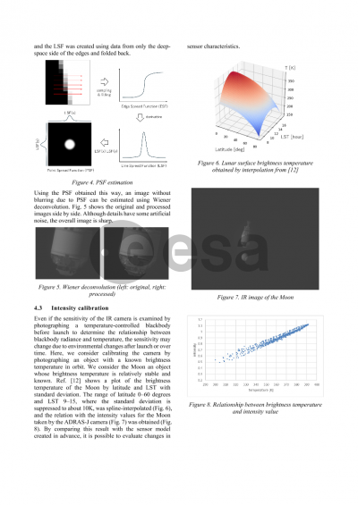
In Phase I of CRD2, the upper stage of the H-IIA rocket used to launch GOSAT in 2009 is used as a target to approach and observe the target using relative navigation. The ADRAS-J satellite of the CRD2 Phase I project was launched in February 2024, and approached and observed the target using relative navigation with various sensors including an infrared camera from April. During this observation, several orbital infrared images were taken from behind the target.
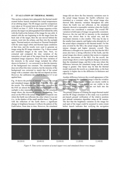
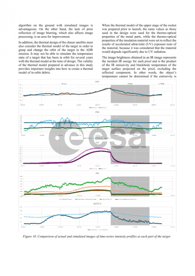
The results of a comparison of simulated and real images are presented to discuss the validity of the simulator and the thermal model, with a focus on the extent to which the simulated infrared images generated by the model assumed in advance adequately represent the real images. The comparison is conducted from the viewpoint of whether the simulator is capable of producing appropriate simulated images to be used for on-ground validation of the navigation algorithm and whether the thermal model is appropriate for validation of the thermal design during target capture.
Preview