Document details
9
1
S. Lemmens, T. Flohrer, F. Schmitz

Abstract
Over the last twenty years, it has been shown in numerous experiments that Space Debris Laser Ranging (SDLR) can be a powerful tool for determining the position of objects in orbit. With a relatively simple and well-established technology, the distance between a ground station and an object in orbit can be derived with an accuracy of a few decimetres. In turn, these measurements can be used to produce highly accurate predictions of orbits for the timespan of one to a few days.
Consequently, this technology has the potential of having a great impact on different aspects of Space Situational Awareness (SSA), and in particular on the assessment of short- and mid-term conjunction warnings. With targeted laser ranging observations, uncertainties about the orbits of defunct objects can be reduced by orders of magnitude, enabling operators to make clear and well-informed decisions about evasive manoeuvres. In a vast majority of cases, manoeuvres can be avoided completely thanks to the high fidelity of the prediction.
Unfortunately, this potential of laser ranging for SSA has so far been exploited poorly. A number of reasons can be put forward, but the lack of availability of easy-to-obtain laser ranging data seems to be at the core. So far, all SDLR efforts in Europe have been conducted in the context of research and studies. For SSA service providers and satellite operators there exists no straightforward way to obtain SDLR data.
To improve this situation, DiGOS has launched a new web platform called “Commercial Laser Ranging Data Exchange” (CLRDE). This activity, which is co-funded by the Competitiveness Segment of the Space Safety Programme of ESA, provides an easy-to-use gateway for SSA service providers and other data users to obtain laser ranging data from numerous ground stations. The organisational and technical overhead, which usually associated with receiving laser ranging data from ground station operators directly, is minimised. To support the introduction of the service to the market, ESA acts as test customer and provides access to data generated with the Izaña laser ranging system in Tenerife.
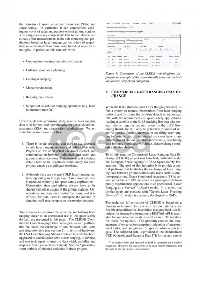
Meanwhile, the Izaña station is being upgraded to develop and test new technologies in laser ranging. To improve data yield, the system is enhanced with functions for autonomous operation. A light curve detector with high temporal resolution has been integrated for object characterisation. Also, a new camera-based aircraft detection system is being tested.
The largest upgrade, however, is the addition of a second laser transmitter system specifically for non-cooperative targets. First successful measurements have been taken to defunct satellites and rocket bodies. A special camera system and corresponding software allow automated guiding of the telescope to enable observation of objects with poor orbit prediction. To enable observations also during the day and increase operation time, the guiding camera system is capable of detecting objects also in daylight.
During the years of 2025 and 2026, the station will be available as makerspace platform for experiments in the domain of laser ranging and related fields. A number of experiments with different partners have already been planned. Parties interested in participating are invited to contact DiGOS or ESA about it.
Preview